[an error occurred while processing this directive] [an error occurred while processing this directive] [an error occurred while processing this directive]

2006/09/27 Flight to Catalina (KAVX) and back
π 2006-09-27 23:06 by Merlin in Flying, Nflying

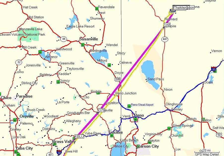
I hadn't gone diving in a while, and Jennifer never got her diver's certification, so I thought it would be a good idea to realize another plan of mine, and fly from Palo Alto directly to Catalina Island (which beats flying commercial, going to the ferry terminal, and taking the ferry by several hours when you compare it to a 2-2.5H flight in a trinidad TB20)

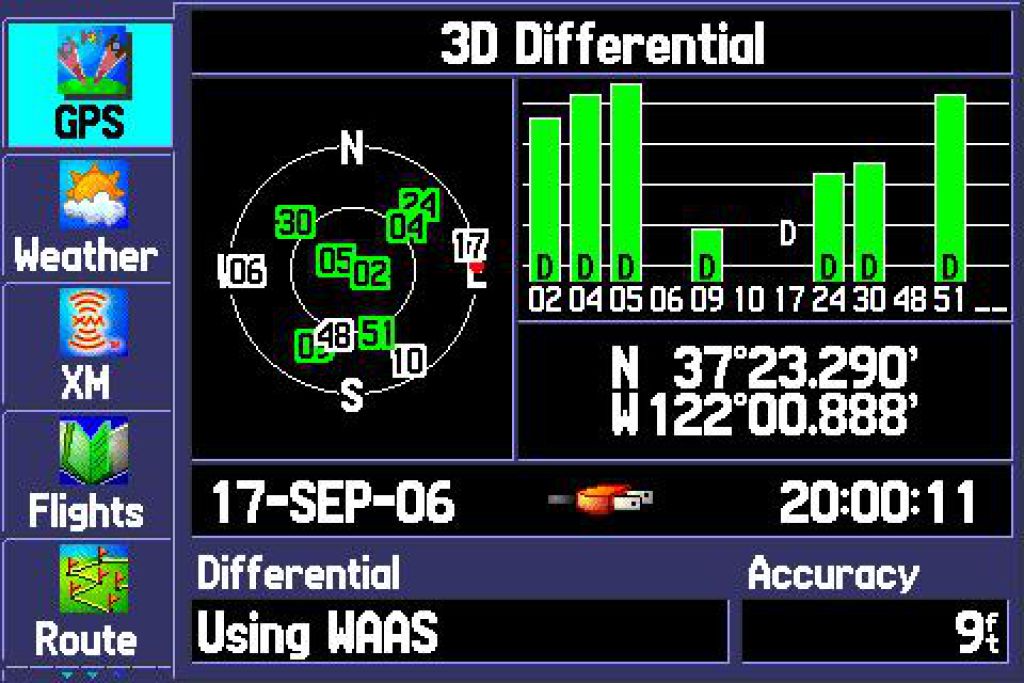
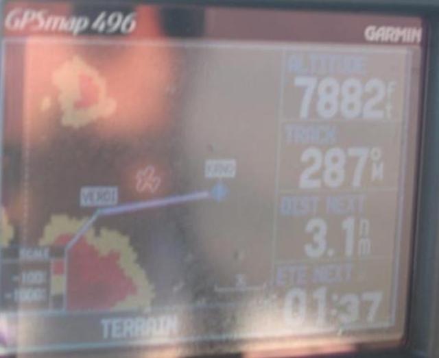
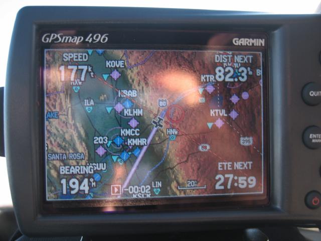
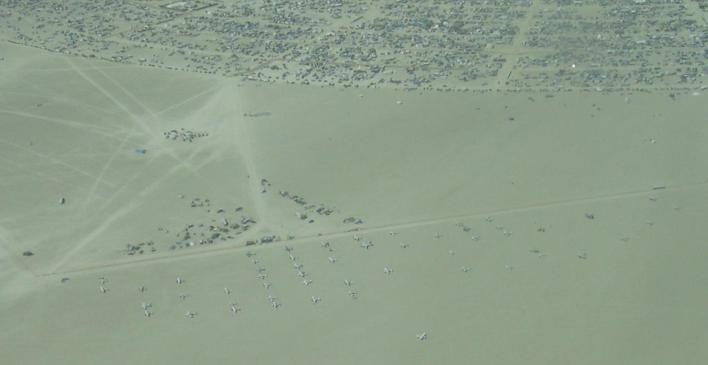
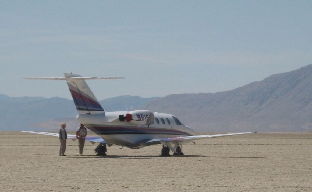
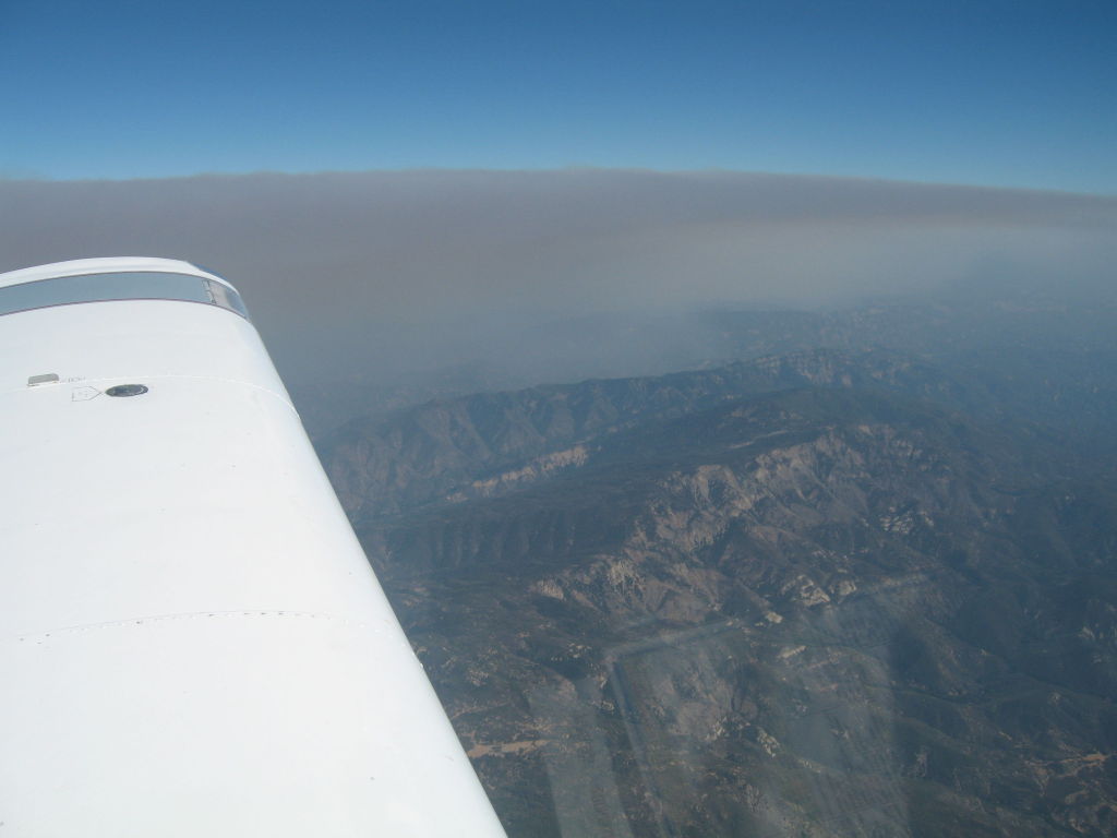
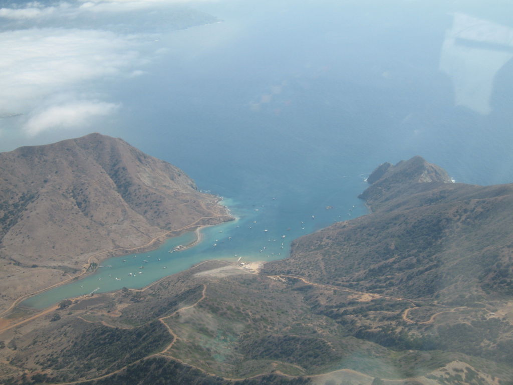
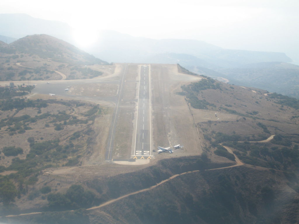
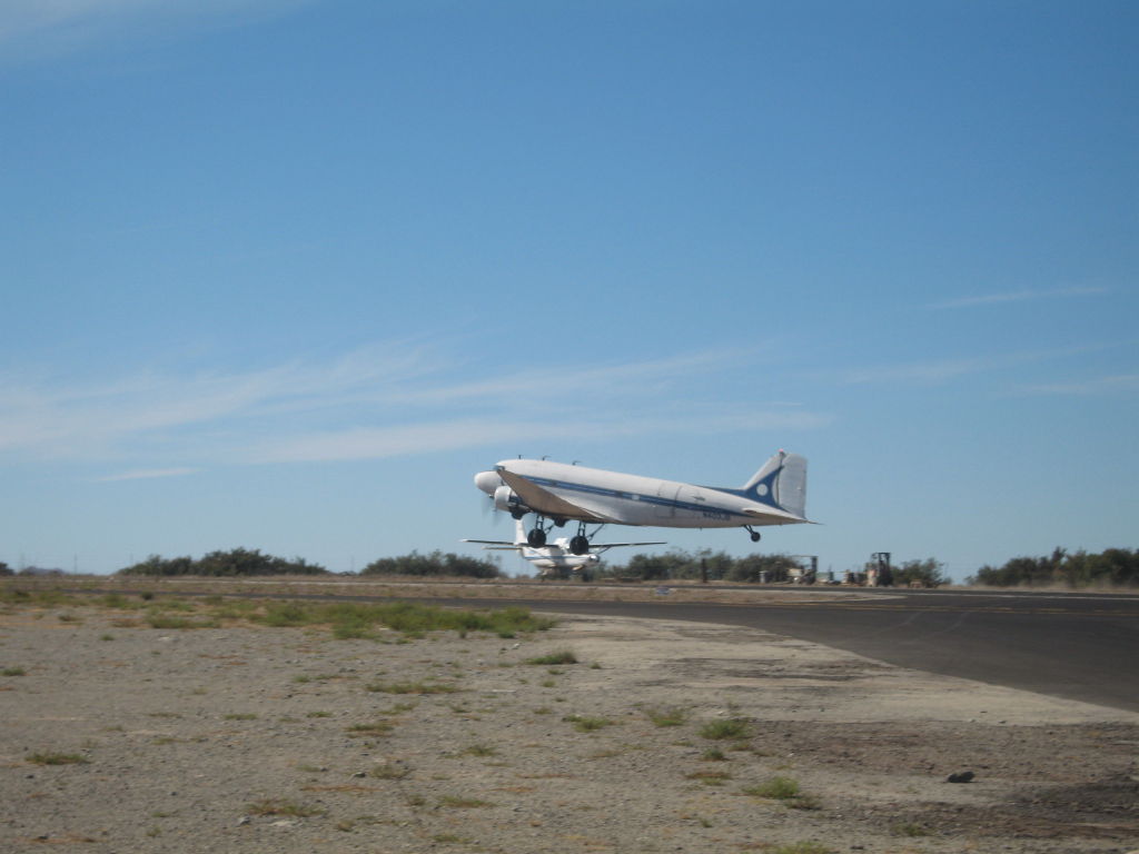
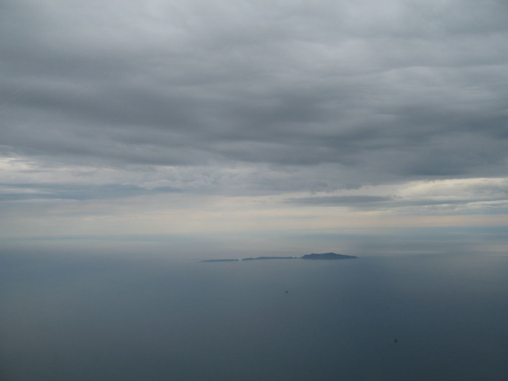
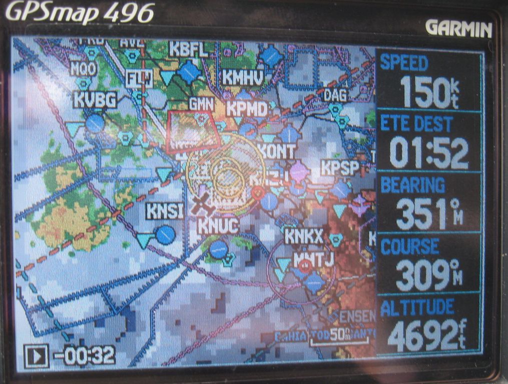
This flight to Catalina was however a perfect justification for the IFR training that I had decided to get, but barely started: we ended up leaving about 2H late due to a persistent overcast in Palo Alto, but ultimately still got to Catalina faster than if we had flown commercial, and no worries about swiss army knifes, baggage at the carrousel, and a potential missed ferry connection :)
By 12:00, PAO had enough of a hole in the clouds that I was able to climb over the top on upwind to the crosswind turn, and was already over the top by the time I ended back on downwind and towards Moffett. The Garmin 496 ended up being quite useful the tops rose increasingly when going south, and I was able to get real time top information, and find a course change that allowed me to leave the bad tops that were over LA when I had climbed to 14,000 feet and the tops were still rising somewhat. I was also able to use my brand new emergency bottle of oxygen that fits in my flight bag.
While climbing higher, I often found myself where I could technically still see some distand ahead of me, and even see the ground somewhat (when looking under the plane, not ahead), but the horizon was gone, so it was a good excercise in soft IFR while still being in technically legal VFR conditions (I did however get out of itby climbing and finding the edge of the clouds on the Garmin, and headind away from there).
The arrival at Catalina was uneventful as it had been VFR all day, with unlimited ceilings, and I got there in time to see the DC-3 air taxi take off soon after I landed. Landing fees, overnight for 4 days, and a return shuttle for two was $75, which all in all was quite reasonable, especially with the brand new paved runway that had just been renovated.


the bad clouds were now on my left, looming over LA


The flight back was even more "interesting", as being October first, we were out of the June-September period of time where it is illegal for rain to occur, and sure enough, by the time we biked up to the airport, we were greeted by IFR conditions with fog to the ground.


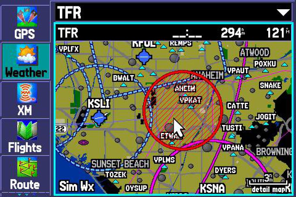
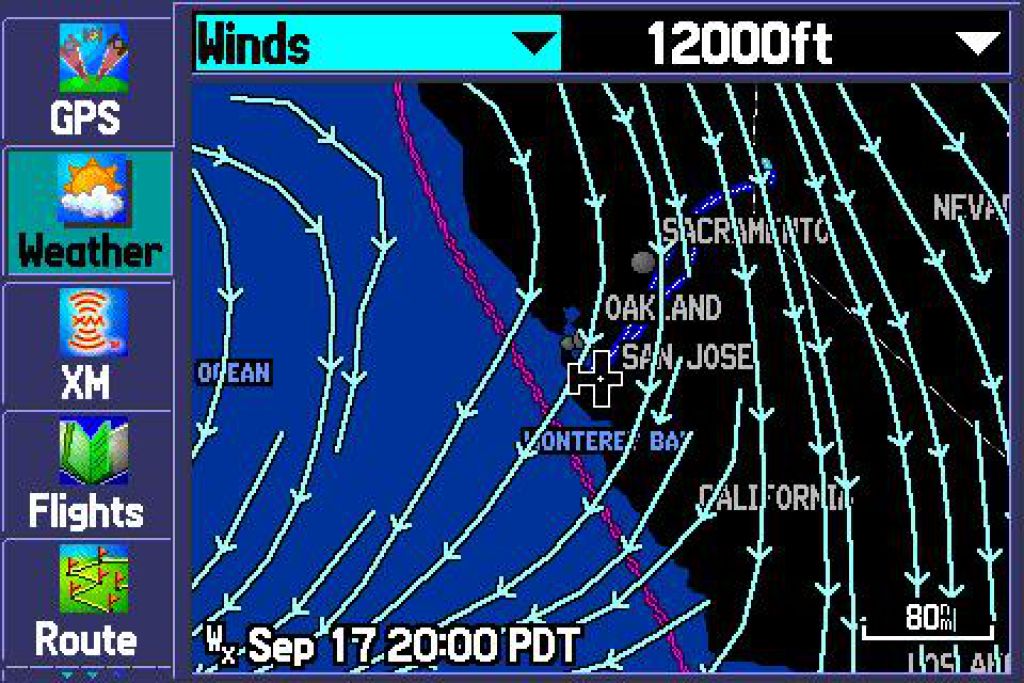
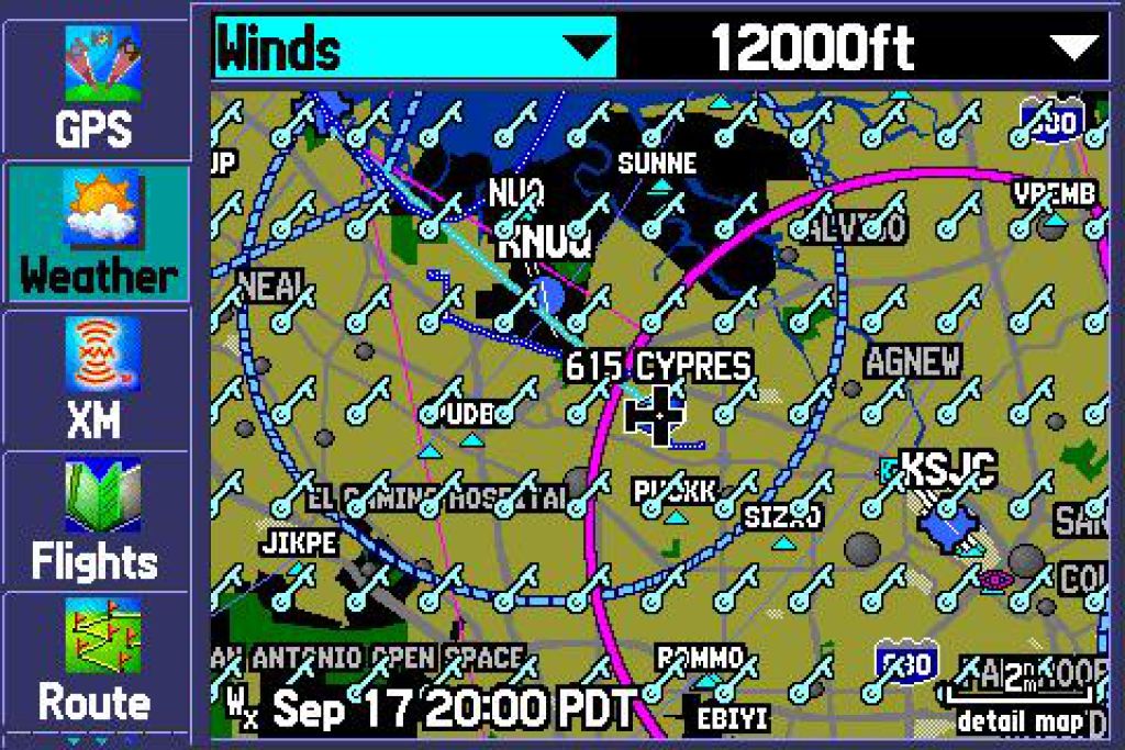
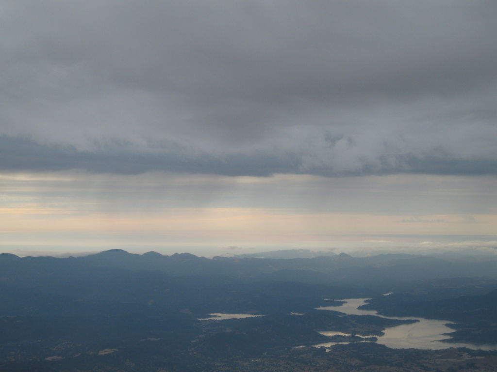
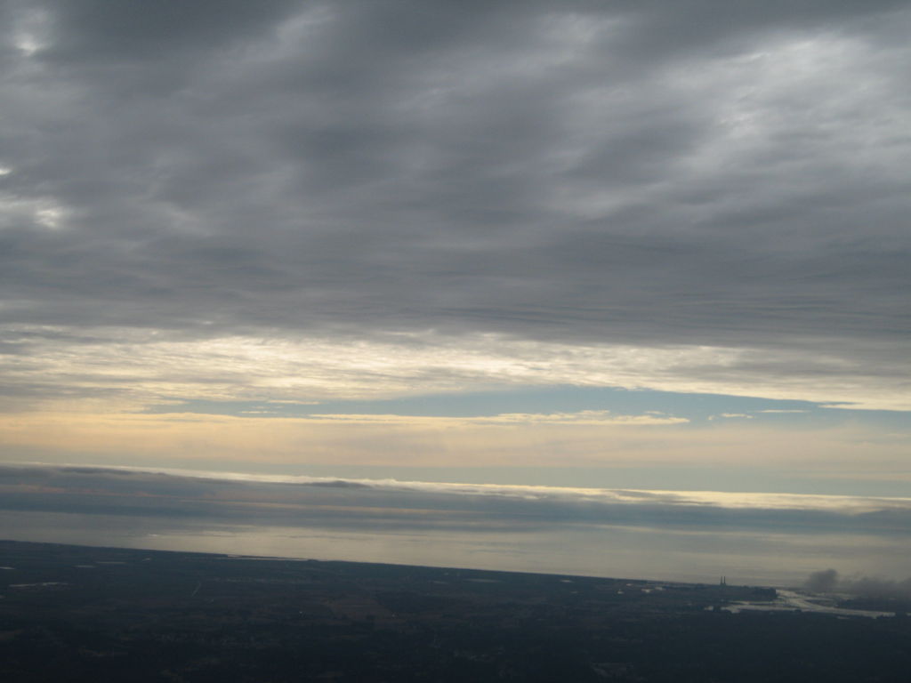
This was not a great sign, and weather forecasts showed rain on the route and low ceilings in the Silicon Valley (less than 4000 feet), so we aborted the rest of the bike ride (which wasn't much fun in dense fog), and planned on leaving a bit earlier than planned (15:00 instead of 17:00), especially so as to ensure a landing during daylight (night + low clouds + mountains in VFR = no good).
On the way back the Garmin 496 with real time XM weather showed the heavier parts of rainstorm, which way it was heading, and showed terrain avoidance making navigation with restricted ceilings easier. The flight back was barely 2H with light rain, smooth air, and outside of a somewhat dicy pass by Salinas which had a TFR that blocked most of the useable route for VFR people who couldn't climb, nor hit the mountains on the east, I was able to fly at 7,500 feet the entire way back until Salinas where I had to duck under the cloud cover below 3000 feet, and was able to navigate safely between mountains back to San Jose and Palo Alto.
All in all, it wasn't a hard flight, but it could have been, and the Garmin 496 is what made me confident enough in knowing where I was heading, and that ahead was going to be ok (of course, that's what flightwatch is for, but they were quite busy).


with weather like this, it was nice to have cloud tops, areas with rain, and TFRs all on the same screen


The SNS TFR, I could have done without... but check out the ground speed :)


2006/09/24 Flight in North American T-6
π 2006-09-24 18:03 by Merlin in Flying, Nflying

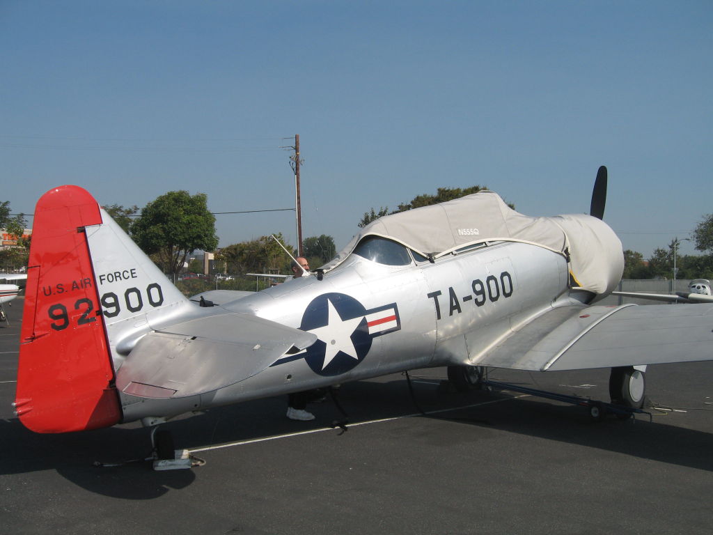
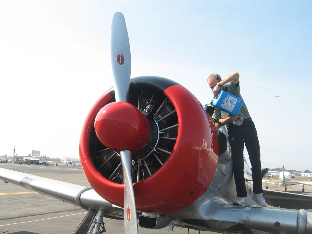
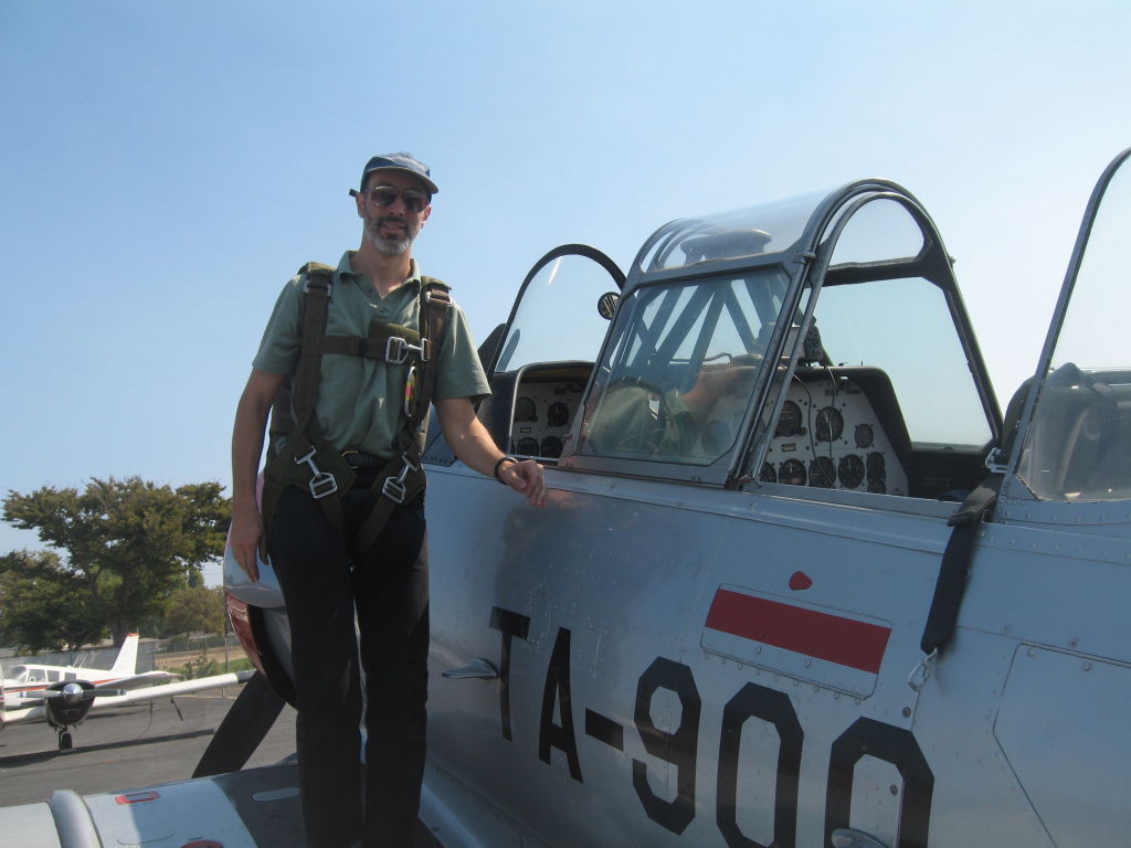
My friend Pablo nicely offered for me to ride shotgun in his partially owned T-6, and we went for a flight in the East Bay. It's definitely an impressive plane, and it's cool to be able to open the canopy while in flight.
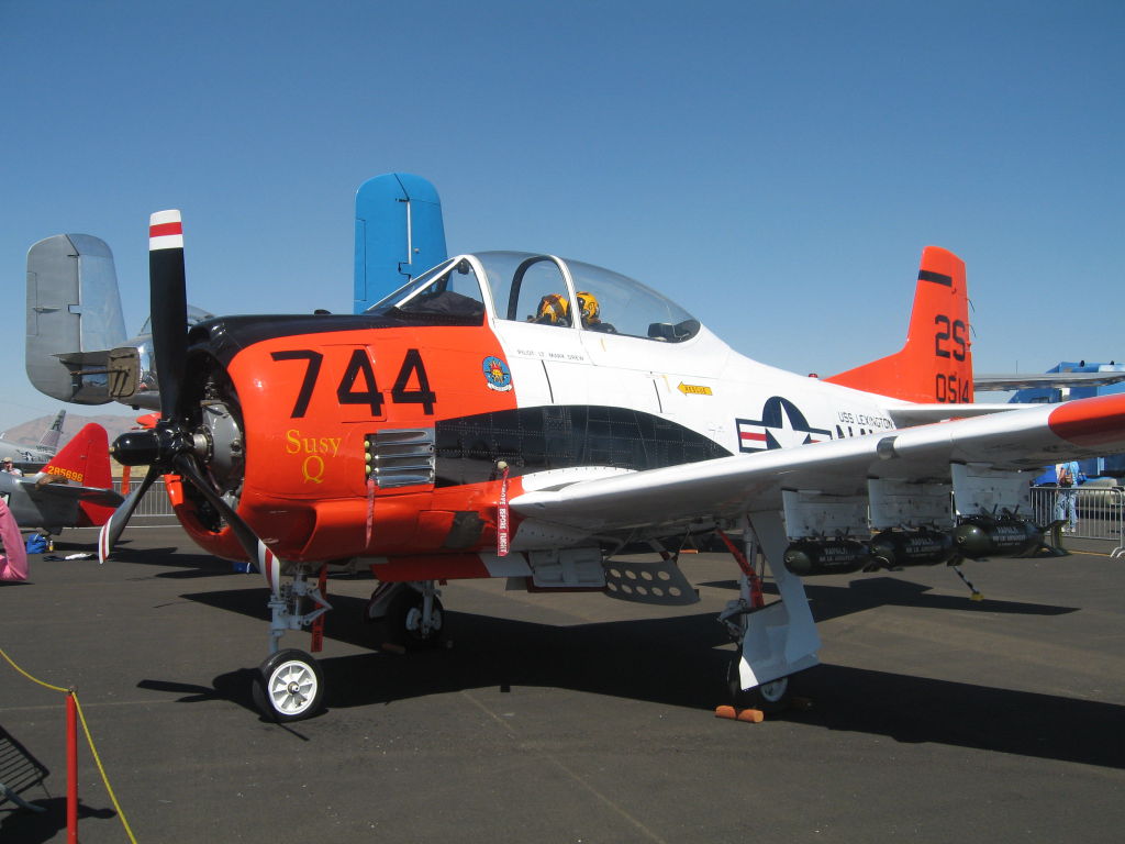
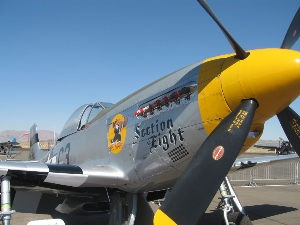
Pablo give me the stick for a little while, but I was a bit apprehensive piloting from the back, and a 600HP plane I didn't really know too well, while being not too awake due to the Techno party I had gone to the previous night, but it was still fun to do a steep turn and see how it handled while Pablo showed me a few manoeuvres (chandelles, lazy-8...), which I was happy to watch instead of having to initiate them :)
All in all, despite the fact that preflight and postflight take about as long as the flight itself, and that it sucks about as much oil as gas :), it was quite cool to ride in an authentic warbird
You can see the rest of the T-6G pictures , and download the GPS track of the flight


2006/09/22 Passed 200H of flight
π 2006-09-22 02:10 by Merlin in Flying, Nflying

I just updated the latest page of my logbook, and got:

Flight Hours: 216.2
Landings: 628
Night Landings: 44
High Perf Aircraft Hours: 62.7
Complex Aircraft: 27.3
Night hours: 12.0
Cross Country: 56.6

Now that I'm past the insurance required 200H, I've been enjoying flying the Trinidad TB-20. Nice and affordable plane.
2006/09/17 Bought a Garmin 496
π 2006-09-17 23:15 by Merlin in Flying, Nflying

I was reading some NTSB reports (i.e. plane accident reports), and read about yet another instance when a plane had been vectored into a mountain, or a plane heading right for a mountain in VFR but with quite poor visibility, never got a call from the air controller who got collision alerts on his radar, because the controller felt the pilot didn't need the help because he was flying VFR (that turned out to be incorrect, but his call cost several lifes).
Anyway, I came to the conclusion that since I had decided that I was going to get my instrument rating (IFR), I would not want to rely on just a few old instruments in the plane, and a controller who after all is human, and could make a fatal mistake one day. It did not seem to make sense to fly without visibility, at night, or in instrument conditions, without a GPS with terrain awareness (i.e. a map showing you terrain around you that is close to your altitude, or above you)

Given that, since I was going to get some new piece of handheld equipment, I decided to go all out and just get the best available today: A Garmin 496 with XM weather. I ordered it overnight on thursday and got it on friday in time for my saturday flight to Reno.
I've then spent most of my Sunday reading the manual and playing with it.
My impressions are:

  • It's really a full IFR GPS except that because Garmin can't get it certified, it says everywhere "not for use for IFR", but it seems much better than most IFR certified GPSes out there
  • It has high resolution terrain awareness, just what I wanted
  • XM weather is quite nice. Ok, it's a $50/month XM satellite radio/weather subscription, but I think that's well worth it if it can help you avoid a mountain wave, or "controlled flight into terrain" (that you couldn't otherwise see)
  • Real Time TFR information is even better. Nowadays, TFRs can pop up anywhere, even while you are in flight, and you are somehow responsible for avoiding all of them. Graphical TFR zones that show up on my moveable map screen just seem essential. Now, if you're sold on that, try up to date AIRMETs, and SIGMETs. That too, is essential in my opinion.
  • XM radio is a nice added touch. I didn't have XM radio at home, and now I do :)
  • It's also a very good car GPS, and even a marine GPS with sonar capability.
  • My first down point on it is that you can't use its internal memory to upload new maps. You have to buy some custom Garmin memory that is huge in size and price. They really should have used an existing format like CF or SD/MMC
  • My other problem with it is that the connectivity it's supposed to have with other Garmin equipment that's already in planes, is effectively useless: you need an aviation shop to do custom wiring work beforehand, which means that as a renter, you can't hope to use TIS (which would have been useful), or exchange data with other avionics inside the plane (A Garmin guy told me that the FAA prevents them from uploading a route or flightplan to an IFR GPS anyway, because their equipment isn't IFR certified, so it can't upload data to IFR equipment. Swell...)

In a nutshell, while it's not cheap, neither is renting a glass cockpit equipped aircraft, and flying with a Garmin 496 comes close, but you can do it in an older plane with antiquated avionics that you can then proceed to mostly ignore.


Unfortunately, the GPS doesn't have RAIM, but still has very good accuracy through tracking up to 12 satellites. I guess you just have to be careful to have a track on enough satellites + WAAS to know that you are getting reliable position data


Two essential features for me were real time TFR info, as well as terrain awareness when you can't see what's around you


Winds are both essential to know which altitude you'll get the best winds at, but also when you're thinking about crossing a mountain ridge


If you lose your instruments, a GPS derived backup might still come in handy


It's not a Garmin 1000 (for one it won't talk to your autopilot), but it gets close

2006/09/16 Flight to the Reno Air Races
π 2006-09-16 23:10 by Merlin in Flying, Nflying

I had planned to do a flight in the trinidad TB20 I just got checked out in, to
see how it behaved on a cross country, and check its typical fuel burn, and when I found out that that weekend happened to be the reno air races, it was a perfect excuse for a flight.
The flight there was barely 90mn thanks to the trinidad's superior speed and no head winds, and after taxing to a very full parking area, we got a quick cab ride to Reno Stead Airport.

I had never seen airplane races, and I had no idea that they do fly next to one another around pilons, although in most cases, they do spread out due to noticeable performance differences between the different planes.
It was interesting to then see the same thing with jet airplanes too ( see more pictures and videos than the two samples below


The intermissions, which were mini air shows, were quite entertaining too, especially the USAF ThunderBirds, which still do an impressive job. A good example was landing a tailwheel on top of a moving RV ( more airshow pictures and videos , and more thunderbird pictures and videos )


Separately from the airshow, and races, there were lots of planes on display, old, and new ones.
The old planes on display were a nice touch (although no rival for what you'd see at the typical moffett air show), and while in the end we only spent about 5H there, it was nice to have been able to j ust pop up, watch a good portion of it, and fly back home afterwards (with record speeds of 160 knots GS and better due to tailwinds)
Below are a few pictures from the airplane display picture library


Anyway, all the pictures and videos are here (thanks much to Warren for his Canon SLR pictures)
2006/09/04 Flight to Burning Man
π 2006-09-04 23:40 by Merlin in Bm, Flying, Nflying

I was excited this year because I went from being a passenger in a small plane headed to BRC, and back, and thinking it would be cool to get my pilot's license, to getting the said license, and managing to rent a plane from the fine folks at Shoreline Flying Club at Palo Alto Airport


The flight was about 1H50 each way, although you have to add pre-flight, tying down the plane, and in my case taping every orifice in the plane to make sure playa dust wouldn't get in (playa dust is not very kind to mechanical hardware, which is why we were all surprised to see some rich folks who showed up just for 6 hours, paid $2000 cash at the gate, and flew in in a Cessna Citation Jet. That was more rich tourist spectator behaviour than in Burning Man spirit...)
Anyway, here's the gps info of the flight, and the city and you can also find more pictures from the flight from KPAO to BRC ).


The airport went over 100 planes this year


welcome home


Virtually all orifices were closed, and the wheel bearings/grease protected


If all customs agents were like this, flying wouldn't be that bad :-)


The lovely black rock travel agency


cleaning the playa dust out of the engines in this planes must suck :-)


A big thank you goes to all the people who made the airport possible yet again, be it setting it up and tearing it down, or manning unicom, to advise incoming pilots. You can see more of the pictures from the airport and The city seen from the sky

While I spent most of my Burning Man time outside of the airport, and in the event (you can read about it here ), but I was still able to see the formation flight that happened (7 planes flying in the shape of the man), as shown in the picture below or video of the formation flight


On the way back, even if going to the airport is a bit of a trek (thanks so much again to Ranger Fixit for the ride there), and factoring in preflight time, as well as taking all the tape and plastic wrap off the plane, it wasn't as bad as the 1.5-2H it took people to get to the road.
I heard that on Monday, the wait time spiked to 4H. Egads! I guess despite the flight planning and pre/post-flight time, this is one of the times where flying makes sense.


All right, I guess there are many rows of cars trying to get onto one small road


The flight home was uneventful for us (a few pictures here ). Luckily I was more awake than my passengers :)


[an error occurred while processing this directive]

Contact Email